Colorado County and Municipal Law
Read about Colorado Governor Hickenlooper's Oil and Gas Development Task Force - Governor John Hickenlooper created the Task Force to identify recommendations regarding issues such as conflicts between local and state regulation, multiple wells production areas, and drilling operations near and within communities. The 21 member group produced nine recommendations that were submitted to the Governor.
In Colorado, both the state and local governments have interests in regulating oil and gas development. The ability of the state to overrule a local government is known as state preemption, and it is currently a hotly debated issue in the regulation oil and gas. Currently, the ability of a local government to regulate oil and gas depends on what type of government it is (home rule or statutory, and county or municipality being the primary distinctions), and whether a particular use of its powers conflicts with state oil and gas regulations.
The Colorado Supreme Court established the current ‘ad hoc’ (meaning case-by-case, on the basis of a fully developed evidentiary record) conflict preemption test for determining the limits of local control in 1992, with its same-day decisions in Voss v. Lundvall Brothers, Inc., and County Commissioners v. Bowen/Edwards and Associates.
Since 1992 there have been two major legislative amendments to the Oil and Gas Conservation Act, C.R.S. § 34-60-101 et seq., in 1994 and 2007, requiring the Colorado Oil and Gas Conservation Commission (COGCC) to consider public health, wildlife, and the environment when regulating oil and gas, and removing control of the Commission from members of industry. The state Attorney General has taken the position that these amendments have expanded the powers of the COGCC to preempt local health, safety, and welfare laws, zoning laws, and nuisance abatement laws.
 The COGCC has engaged in several rulemaking efforts since 1992 as well, including a major regulatory overhaul in 2007-08. These COGCC regulations have specifically recognized the role of local governments, including establishing a position of Local Government Designee and requiring that they be invited to participate in development of Comprehensive Drilling Plans. 2 CCR 404-1:214 (2009); 2 CCR 404-1:216(d)(2 (2009). Although Colorado rules also provide that the permit to drill is “binding with respect to any operationally conflicting local governmental permit or land use approval process. 2 CCR 404-1:303(a)(2) (2009). Several counties and municipalities in Colorado have designated government personnel to serve as liaisons with the Colorado Oil and Gas Conservation Commission (COGCC). The list of local government designees (LGDs) and their contact information can be found on the COGCC’s website (click on "Local Governments," then click on "Listing of Participating LGDs"). The COGCC has engaged in several rulemaking efforts since 1992 as well, including a major regulatory overhaul in 2007-08. These COGCC regulations have specifically recognized the role of local governments, including establishing a position of Local Government Designee and requiring that they be invited to participate in development of Comprehensive Drilling Plans. 2 CCR 404-1:214 (2009); 2 CCR 404-1:216(d)(2 (2009). Although Colorado rules also provide that the permit to drill is “binding with respect to any operationally conflicting local governmental permit or land use approval process. 2 CCR 404-1:303(a)(2) (2009). Several counties and municipalities in Colorado have designated government personnel to serve as liaisons with the Colorado Oil and Gas Conservation Commission (COGCC). The list of local government designees (LGDs) and their contact information can be found on the COGCC’s website (click on "Local Governments," then click on "Listing of Participating LGDs").
LOCAL CONTROL INITIATIVES
The COGCC has engaged in several rulemaking efforts since 1992 as well, including a major regulatory overhaul in 2007-08. These COGCC regulations and subsequent rulemakings have specifically recognized the role of local governments, including establishing a position of Local Government Designee and requiring that they be invited to participate in development of Comprehensive Drilling Plans. 2 CCR 404-1:214 (2009); 2 CCR 404-1:216(d)(2 (2009). Although Colorado rules also provide that the permit to drill is “binding with respect to any operationally conflicting local governmental permit or land use approval process. 2 CCR 404-1:303(a)(2) (2009). Several counties and municipalities in Colorado have designated government personnel to serve as liaisons with the Colorado Oil and Gas Conservation Commission (COGCC). The list of local government designees (LGDs) and their contact information can be found on the COGCC’s website (click on "Local Governments," then click on "Listing of Participating LGDs").
Nevertheless, public opinion against oil and gas development has been rising in some areas due to the increase in drilling in heavily populated or suburban locations, and also a growing body of evidence of environmental or health risks. There are currently estimated to be approximately 41,000 actively producing wells, out of over 100,000 wells overall. See here for the most current data. The “boom” is having major negative effects that are felt at the local level and by individuals who may not be receiving compensatory benefits. Beginning in 2012 with the home rule municipality of Longmont, local citizens and their representatives have voted to ban or suspend some types of oil and gas operations, or restrict areas that may be developed, despite the standing precedent of Voss and Bowen/Edwards and threats of legal action from the state.
Moratoria, statewide and local ballot initiatives, the Governor’s Task Force on Cooperative Strategies regarding State and Local Regulation of Oil and Gas Development, and two 2016 Colorado Supreme Court decisions (City of Longmont v. Colorado Oil and Gas Association and City of Fort Collins v. Colorado Oil and Gas Association on oil and gas moratoria all suggest that local governments and operators take a hard look at state and local regulations and non-regulatory strategies for ensuring that oil and gas development is compatible with their communities. Memoranda of Understanding (MOUs) with operators, also known as Local Government – Operator Agreements, have been a non-regulatory alternative or supplement for several Colorado communities since 2005.
For a case study local government regulation in Colorado, see Local Government Fracking Regulations: A Colorado Case Study
For more information on MOUs, see our Memorandum of Understanding page.
TYPES OF LOCAL GOVERNMENTS
Home rule is the principal that local governments are empowered directly by the people, and do not require enabling legislation from the state government to enact regulations. The state may still pre-empt some areas of local regulation, either by express preemption where "the express language of the statute may indicate state preemption of all local authority over the subject matter,” implied preemption where “the state statute impliedly evinces a legislative intent to completely occupy a given field by reason of a dominant state interest" or conflict preemption "where its operational effect would conflict with the application of the state statute." (quotes from Bowen/Edwards). Municipal governments have exclusive control over issues that are purely local, although where both the state and local government have interests in a matter a local government may not enact regulations that conflict with the state regulation.
Home rule was granted to the people of Colorado by constitutional amendment in 1902, and expanded in 1912 and 1970. See Colo. Const. Art. XX. The Colorado Supreme Court has interpreted these constitutional powers broadly, holding that “the power of a municipal corporation should be as broad as possible within the scope of a Republican form of government of the State.” Fort Collins v. Public Utilities Comm’n, 69 Colo. 554, 556 (Colo. 1921). Counties were not granted home rule until 1972, and their form of home rule is a more limited form that allows independent control of the local government itself, but no power to enact functional regulations without state authorization (a ‘structural’ as opposed to ‘functional’ home rule). See Colo. Cost. Art. XIV § 16.
Governments that do not elect home rule status are statutory by default, and are considered political subdivisions of the state (see Dillon’s Rule). They require enabling legislation from the state government to empower them to enact local regulations.
Counties that elect home rule status have a more limited form of home rule than do municipalities. However, the state has enacted many laws that empower counties to control local land use, including the County Planning Act [Biblio: C.R.S. § 30-28-101 et seq.], the Local Government Land Use Control Enabling Act (Land Use Enabling Act) [Biblio: C.R.S. § 29-20-101 et seq.], and the Areas and Activities of State Interest Act (AASIA) [Biblio: C.R.S. § 24-65-101, et seq.].
Municipalities in Colorado may take any of five governmental forms, including home rule, statutory city, statutory town, consolidated city and county, and territorial charter municipality (Georgetown is the only municipality still operating under Colorado’s original territorial charter). Municipal rule outside of home rule jurisdictions is authorized by the Local Government Land Use Control Enabling Act (Land Use Enabling Act) [Biblio: C.R.S. § 29-20-101 et seq.],
Colorado Counties
Adams | Arapahoe | Boulder | Broomfield | Chaffee | Cheyenne | Delores | Douglas | Elbert | Garfield | Gunnison | Jefferson | La Plata | Larimer | Mesa | Moffat | Morgan | Pitkin | Rio Blanco | Saguache | San Miguel | Weld | Yuma
Adams County
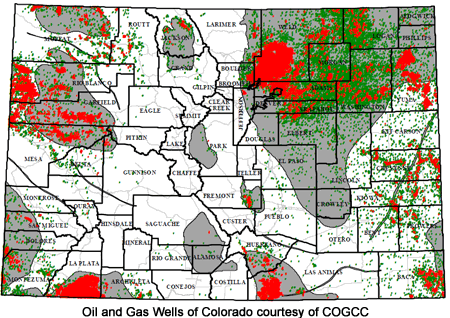
Adams County just northeast of Denver is the fifth most populous Colorado county, growing over 20% between 2000 and 2010 to nearly half a million people, and currently has approximately 40 producing operators and 650 active wells (from a total of about 4,100). The county defers all regulation to the COGCC.
Arapahoe County
Arapahoe County, bordering the southern and eastern edges of Denver, is the third most populous county in Colorado. The eastern portions of Arapahoe County have experienced increased oil and gas exploration in recent years because it overlies Niobrara shale. For example, in 2012, the Colorado State Land Board approved an oil and gas development lease on the 26,000 acre Lowry Range located in Arapahoe County. In 2013, Arapahoe County added an oil and gas section to its Land Development Code (12-1900) for the unincorporated portions of the county.The County also approved a Memorandum of Understanding, which requires increased county oversight of operations and more stringent standards than state regulations, but allows the oil and/or gas producer to access a faster, less costly administrative permitting process. The county website addresses oil and gas questions here.
Boulder County
Boulder County is home to nearly 300,000 residents and includes some of the most diverse, natural landscapes and sustainable development along the Front Range. Historically, Boulder is home to second-oldest oilfield in Colorado, with the historic McKenzie Well #1 on the National Register of Historic Places. While there is not significant oil and gas development in the county, on February 2, 2012, the Boulder County Board of County Commissioners (BOCC) approved a temporary moratorium on the processing of oil and gas permits in order to update the County’s Comprehensive Plan and Land Use Code. On August 15, 2012, the Boulder County Planning Commission adopted changes to the oil and gas policies in the Comprehensive Plan. The BOCC adopted Resolution 2012-142 approving the updated oil and gas Land Use Code amendments on December 20, 2012 and Resolution 2013-49 to amend the transportation sections of those regulations. (For a detailed history of events during 2012, please visit the Land Use Department’s webpage).
Chaffee County
Chaffee County is on the eastern slope of the Rocky Mountains in central Colorado. There is not significant oil and gas development in the county, although there is significant mining and gravel extraction. The County is in the process of revamping the land use code for the last several years in order to better serve the needs of the community. The county adopted new land use code in 2014, Ordinance 2014-01, although it does not address oil and gas.
Cheyenne County
Cheyenne County is located in eastern Colorado on the Colorado-Kansas border. Cheyenne is one of the top three leading counties for oil production in Colorado. The county does not have local regulations specific to oil and gas; rather the county primarily relies on state and federal regulation to control oil and gas development. There was a new oil discovery here in 2013.
Delores County
Delores County is located near the southern end of the western border of Colorado, and is the seventh least-populous county in the state, with a population of only about 2000 people as of the 2010 census. However the county does contain development, particularly natural gas development, and there is the potential for future oil shale development here. Its Land Use Code is largely silent on specific regulations pertaining to oil and gas development.
Douglas County
Douglas County is located in eastern Colorado between Denver and Colorado Springs. The county began to see expanded oil and gas leasing in 2011. The County is in the process of developing local regulations for oil and gas development, and completed a transportation impact study in 2012. See the County’s oil and gas page for more detail.
Elbert County
Elbert County is located in eastern Colorado between Denver and Colorado Springs neighboring Douglas County. There is not significant oil and gas development in the county currently; however, recently located natural gas deposits are partially located in Elbert County generating potential development in the county. In January of 2014 the county approved new regulations allowing an expedited administrative approval process for producers who agree to the county drafted Memorandum of Understanding.
Garfield County
Garfield county is located on the western border of the state and includes the cities of Battlement Mesa, Glenwood Springs, and Rifle. There is a significant amount of oil and gas development in the county as much of the County is part of the Piceance Basin. The County has a County Oil and Gas Department that serves as a liaison between the citizens of Garfield County and the energy industry and plays a significant role in the regulation and development of oil and gas resources in Garfield County. The Garfield County Energy Advisory Board was established in 2004 to provide a forum for the oil and gas industry, the public, impacted landowners, and local government entities to prevent or minimize conflict associated with oil and gas development to encourage development of resources within Garfield County. The County has also drafted a Unified Land Use Resolution. The County Commissioners have consistently been pro-industry in their approach to regulation at the federal, state (see also), and local level.
Garfield County has issued several oil and gas guidance documents that include:
Draft Garfield County Oil and Gas Primer: How to Navigate Garfield County Zoning Regulations – This document is intended to serve as a guide for operators, contractors, and consultants involved in pursuing projects related to the development of oil and gas in Garfield County. It contains the County Zoning Regulations that govern the most common types of oil and gas projects.
Garfield County Energy Advisory Board’s Community Guide: Understanding Natural Gas Development – This user-friendly Guide provides a general overview of the drilling and processing of natural gas. It also explains legal issues surrounding split estates, major applicable state and federal regulations, environmental concerns related to air quality, water quality, and surface impacts, and provides information about the implementation of best management practices.
Gunnison County
Gunnison County Oil and Gas Regulations: Gunnison County is located in southwestern Colorado. The Piceance Basin (which contains significant reserves of coal, natural gas, and oil shale) underlies a portion of the county. A high level of oil and gas development in Gunnison county and surrounding areas prompted the County to enact temporary regulations specific to oil and gas in 2003. The Gunnison County Board of Commissioners voted on August 28, 2012 to pass Resolution #2012-25, which amended the regulations.
Discussions regarding Gunnison County oil and gas development have to date focused on three areas: improvements to use of the state “local government designee” process, improvements to the Gunnison County regulatory process, and improved inspections.
Provisions of particular interest include: § 1-103 (categorizing oil and gas operations), 104 (application requirements, including site planning and analysis of environmental impacts and emergency responses), and 108 (operation standards, including non-degradation, mitigation, and financial surety requirements). The county also put out a Best Management Practices Field Guide for the Construction of Low-Volume Service Roads – a guide to building remote roads that aims to help build better, more cost-effective roads and to minimize adverse environmental impacts and protect water quality.
Jefferson County
Jefferson County is the fourth most populous county in Colorado, and lies immediately west and southwest of Denver, and includes the City of Golden. Jefferson County currently has only 65 wells and historically has not been a producer of oil except for one marginal well completed in 1955 and abandoned in 1962. Jefferson County does contain coal deposits, from which coalbed methane may be extracted. Its land use code indicates that “oil or natural gas drilling operations or the extraction of minerals” is conditionally permitted (see Table 3.3.3) in agricultural areas with lot sizes of 40 acres or more.
La Plata County
La Plata County is located in the southwest corner of Colorado and includes the city of Durango. Both the Paradox Basin and the San Juan Basin lie within the county, which leads to a significant amount of oil development and especially natural gas development. La Plata County is one of the top three natural gas producers in the state. La Plata County enacted its Oil and Gas Regulations (select Chapter 90, Article II) "to facilitate the development of oil and gas resources within the unincorporated area of the county while mitigating potential land use conflicts between such development and existing, as well as planned, land uses." The regulations are generally intended "to protect and promote the health, safety, morals, convenience, order, prosperity, and general welfare of present and future residents of the county." (§90-17). The La Plata County regulations were adopted as part of the La Plata County Code and are administered by the La Plata County Board of Commissioners. The regulations were updated in November 2008 and again in 2010 (specifically the land use code). Provisions of particular interest include § 90-19 (definitions), 41 (application requirements including site and operating plans and mitigation measures), 108 (permit review criteria), 123 (environmental quality standards), and 124 (surface impact standards). The county provides an oil and gas FAQ available here. The planning process for the county’s oil and gas regulation can be found here.
Larimer County
Larimer County is the seventh most populous county in Colorado, and includes the cities of Fort Collins and Loveland. It borders Wyoming just east of the Rocky Mountains. Larimer County is not a major producer of oil and gas, with less than 200 currently producing wells. The county’s Land Use Code § 4.3.7(F) defines oil and gas development as an industrial use and requires an access fee.
Mesa County
Mesa County lies on the Western border of Colorado and overlies the Piceance Basin, a major gas bearing formation. Five municipalities sit within its boundaries, including the city of Grand Junction and the town of Palisade. There has been significant oil and gas development in Mesa County, although production has been declining with the low price and abundant supply of natural gas. The local land use code regulating oil and gas can be accessed from the Mesa County Website. The county Land Use Code § 5.2.16, regulates oil and gas drilling and may require environmental restoration, financial sureties, visual mitigation, and weed and pest control.
Mesa County
Moffat County is the northwestern most Colorado county, and also the second largest. It has over 2,200 wells, nearly 400 of which are currently producing. Moffat County requires permits for certain oil and gas related activities such as rig movement, but generally does not impose additional regulations above state requirements.
Montezuma County
Montezuma County lies on the Western border of Colorado just south of Mesa County, and similarly overlies the Piceance Basin. Drilling in Montezuma County is for carbon dioxide as well as natural gas. The county Land Use Code does not address oil and gas development.
Morgan County
Morgan County is a largely rural, agricultural county that lies halfway on the diagonal between Denver and the northeast corner of Colorado. Because the petroleum-bearing geological formations thin as they move eastward across Colorado, most of the development is concentrated west of Morgan County.
Pitkin County
Pitkin County is located in central-western Colorado and includes the city of Aspen. The Piceance Basin runs along the western edge of Pitkin County. Chapter Four of the Pitkin County Code, last updated by the Board of County Commissioners in 2006, covers permitted and special review uses and addresses oil and gas development. Pitkin County Oil and Gas Regulations are found at Chapter 4 of its Land Use Code. Oil and gas development is classified as a special review use, and requires review (described at § 2-40-20(a)-(e)) by the County Commissioners in certain areas. Performance standards include emergency response, fire and floodplain protections, agriculture and irrigation protections, site security, and numerous mitigation measures including waste removal, weed control, and visual impact mitigation. There are also requirements for pipeline and gathering systems. These requirements may not be waived for technological infeasibility and the burden is on operators to demonstrate compliance. See generally § 4-10 through 4-30 for provisions of note.
Rio Blanco County
Rio Blanco County is located in rural northwestern Colorado. The two communities of Meeker and Rangely are located within the County. Approximately 75% of county lands are federally owned and include parts of the White River and Routt National Forests. The County has nearly 7,000 wells, of which over 2,100 are currently producing. The local permitting requirements can be located on the Rio Blanco County website. Local regulations can be found at Article X, Section 410 of the county Land Use Code.
Saguache County
Saguache County is located in the Rocky Mountains in South, Central Colorado. Over 70% of the land in Saguache County is publicly owned with the majority being national forest, national park, or BLM managed lands. There is some oil and gas development in the County and extensive regulations have been developed to control development that incorporates BMPs and regulation of hydraulic fracturing. The County’s regulations can be found at Article XXI of its Land Development Code.
San Miguel County
San Miguel County is located on the southwestern border of Colorado. The County includes the city of Telluride and the Uncompahgre National Forest. The Paradox Basin underlies most of San Miguel County. The San Miguel County Oil and Gas Regulations (select Article 5, then see § 5-26): are intended "to provide for the development of oil and gas resources within the unincorporated area of San Miguel County while mitigating potential land use conflicts between such development and existing, as well as planned, land uses and the natural environment." The San Miguel County regulations were adopted as an amendment to the County Land Use Code in 2006 by the San Miguel County Board of Commissioners. Additionally, San Miguel County "encourages the use of directional drilling, the placement of multiple wells on a single site, the use of evaporation pits rather than water injection stations, and other innovative techniques, and provides for the supplemental use of the Bureau of Land Management Gold Book (Surface Operating Standards for Oil and Gas Exploration and Development), the Gunnison Sage-grouse Rangewide Conservation Plan, and the San Miguel Basin Gunnison Sage-grouse Conservation Plan as guidance for the land use development and review process and the required mitigation of potential impacts. San Miguel County also encourages the avoidance of critical wildlife habitat areas, wetland areas, floodplains, and geohazard areas." (§5-2601(A)).
Weld County
Weld County is located in northern-central Colorado, extending to the Wyoming border just east of Fort Collins. The County boasts the largest number of oil and gas wells in the state with nearly half the total, at over 20,000 wells, and in 2013 accounted for nearly 80% of the state’s total oil output. Weld County generally opposes oil and gas regulation. The County has issued permitting guidance, but generally does not impose any higher standards than the state requires.
Yuma County
Yuma County is located at the northern edge of Colorado’s eastern border, and has some major development with over 3,700 currently producing wells (from a total of nearly 6,200). Being at the eastern edge of the DJ basin, the wells here produce mainly natural gas. The County Land Use Code can be accessed from the Yuma County website. Oil and Gas Development is considered a Major Land Use under the Yuma Land Use Code (§ 10-101), and the permit application and review procedures can be found at § 4-104 and 5-103 & 104.
Colorado MUNICIPALITIES
Alma | Aurora | Boulder | Broomfield | Cedaredge | Collbran | Durango | Fort Collins | Grand Junction | Jamestown | Lafayette | Longmont | Louisville | Manitou Springs | New Castle | Rico | Thornton
The following are provided as examples of the variety of municipal oil and gas regulations currently in place throughout Colorado. It is not intended to be a comprehensive list. Please contact us to add additional municipalities: Go to the ADD INFO page.
Click on the link to view the city's ordinances; choose the specific chapter or section indicated in parentheses.
In 2011, the Town of Alma updated Article 4 of its municipal code, which covers Alma’s Watershed District. Pursuant to Article 4, it is unlawful for any person to engage in drilling operations and surface and subsurface mining operations within the Watershed District unless the person obtains a permit. If the Town makes a finding of “minor impact,” the Town must issue a permit for the proposed impact. If the Town finds more than a minor impact from the proposed activity, the permit goes through a public hearing process. A permit will be issued upon a finding that the applicant has proved that the proposed activity does not present or create a foreseeable risk of pollution to Beaver Creek or the Town waterworks or any water tributary sources for five miles above any point from which water is diverted for use by the Town. The Town retains the right to stop the permitted activity if it finds that the activity is being done in a contrary manner to the provisions of the Ordinance. The town of Alma may assess penalties of $300 a day per violation.
City of Aurora Building and Zoning Code (Ch. 146, art. 12, sec. 7)
In November of 2013, the City of Boulder was one of four local governments with oil and gas questions put on the ballot. Voters approved Question 2H with nearly 80% approval. The measure extends a moratorium on new oil and gas exploration, and the use of hydraulic fracturing, for five years. No lawsuit has been filed against Boulder over this issue.
The incorporated city and county of Broomfield operates as a home rule municipality under Art. XX § 10-13 of the Colorado Constitution, after beginning as a municipality it became its own county in 2001. In 2013, the city and county of Broomfield voted by a narrow margin to suspend the use of hydraulic fracturing as well as the disposal or storage of fracking wastes for five years.
In July of 2008, the Town of Cedaredge signed a Memorandum of Understanding with the U.S. Department of Agriculture Forest Service. Pursuant to the Memorandum of Understanding, the Town will have an opportunity to review and comment on applications to the Forest Service concerning oil, gas, and mineral exploration, development, production and reclamation plans. The Forest Service will be afforded the opportunity to review and comment on a variety of applications which may impact public lands, including zoning regulations.
In October of 2010, the Town of Collbran approved an Ordinance adopting new regulations concerning Watershed Protection. Pursuant to Title 9 of Collbran’s regulations, it is unlawful for any person to engage any surface or subsurface mining or mineral resource extraction, including any and all oil and/or natural gas drilling, extraction, or mining without first obtaining a permit. If the Town makes a finding of “no impact,” the Town must issue a “no impact” permit. If the Town finds an impact from the proposed activity, the permit goes through a public hearing process. A permit will be issued upon a finding that the applicant has proved that the proposed activity does not present or create a foreseeable risk of damage or injury to or pollution of the Town of Jamestown waterworks. The town of Collbran may assess penalties of $1,000 a day per violation.
City of Durango Code of Ordinances (Ch. 27, sec. 10-12)
In November of 2013, the City of Fort Collins (a home rule municipality) was one for four local governments with oil and gas questions on the ballot. Voters approved Question 2A with 55% approval. The measure established an ordinance prohibiting for five years the use of hydraulic fracturing or storing fracking waste within city limits. COGA filed a lawsuit against the city ordinance in December of 2013. For background on the issues in Fort Collins, see a 2013 proposal by the City to ban fracking within the city boundary.
City of Grand Junction
In June of 2011, the Town of Jamestown approved an Ordinance concerning the town waterworks and watershed. Pursuant to the Ordinance, it is unlawful for any person to engage in drilling operations within the Watershed District unless the person obtains a permit. If the Town makes a finding of “no impact,” the Town must issue a “no impact” permit. If the Town finds an impact from the proposed activity, the permit goes through a public hearing process. A permit will be issued upon a finding that the applicant has proved that the proposed activity does not present or create a foreseeable risk of damage or injury to or pollution of the Town of Jamestown waterworks. The Town retains the right to stop the permitted activity if it finds that the activity is being done in a contrary manner to the provisions of the Ordinance. The town of Jamestown may assess penalties of $1,000 a day per violation.
In November of 2013, the City of Lafayette (a home rule municipality) was one for four local governments with oil and gas questions on the ballot. Voters approved Question 300 with 60% approval, and banned all oil and gas development and related activities within the city. COGA filed suit against Lafayette in December of 2013. City of Lafayette Code of Ordinances (§ 26.22-1)
Longmont is a home rule municipality. In July of 2012, the Longmont City Council voted to approve new oil and gas regulations (Ordinance 2012-25), limiting oil and gas development within the city. A lawsuit against the city was filed in the same month by COGA, and joined by the COGCC. In November of 2012, the citizens of Longmont passed Ballot Question 300, which bans hydraulic fracturing within the city.
City of Louisville Code of Ordinances (Ch. 17.68)
In June of 2011, the Town of Jamestown approved an Ordinance that concerned the town waterworks and watershed. Pursuant to the Ordinance, it is unlawful for any person to engage in drilling operations within the Discharge Area of the Watershed District unless the person obtains a permit. Further, any activity that may foreseeably cause seismic damage to Manitou Springs’ water supply is illegal without a permit. Seismic damage is defined as “the effect of blasting construction or other purposes causing the opening of fractures and the onset of water flowing from the historic springs aquifer.
If the Town makes a finding of “no impact,” the Town must immediately issue a “no impact” permit. If the Town finds an impact from the proposed activity, the permit goes through a public hearing process. A permit will be issued upon a finding that the applicant has proved that the proposed activity does not present or create a foreseeable risk of damage or injury to or pollution to the historic mineral springs.
In June of 2011, the Town of New Castle updated Chapter 13.40 of the Municipal Code regarding New Castle’s Watershed Protection District. Pursuant to Chapter 13.40, it is unlawful for any person to engage in drilling operations within the Watershed District unless the person obtains a permit. If the Town engineer makes a finding of “de minimis impact,” the Town must immediately issue a “de minimis impact” permit. If the Town finds an impact from the proposed activity, the permit goes through a public hearing process. A permit will be issued upon a finding that the applicant has proved that the proposed activity does not present or create a foreseeable risk of damage or injury to or pollution of the Town of New Castle’s waterworks. The Town retains the right to stop the permitted activity if it finds that the activity is being done in a contrary manner to the provisions of the Ordinance. The town of New Castle may assess penalties of $1,000 a day per violation.
In June of 2011, the Town of Rico approved an Ordinance concerning the town waterworks and watershed. Pursuant to the Ordinance, it is unlawful for any person to engage in drilling operations within the Watershed District unless the person obtains a permit. If the Town makes a finding of “no impact,” the Town must issue a “no impact” permit. If the Town finds an impact from the proposed activity, the permit goes through a public hearing process. A permit will be issued upon a finding that the applicant has proved that the proposed activity does not present or create a foreseeable risk of material injury to the Town’s waterworks, water supply, or any water tributary sources for five miles above any point from which water is diverted for use by the Town.. The Town retains the right to stop the permitted activity if it finds that the activity is being done in a contrary manner to the provisions of the Ordinance. The town of Rico may assess penalties of $40 to $1,000 a day per violation; the town may also assess jail time as appropriate.
City of Thornton Code of Ordinances (Ch. 18, art. VI)
Additional Resources
Protecting Source Water in Colorado During Oil and Gas Development - This guide, released August 2016, is intended for water providers and community members interested in learning more about regulatory and non-regulatory measures to protect water quality. The focus of the report is how water providers and local governments can work with regulators and the oil/gas industry to negate potential impacts from oil and gas development to drinking water sources.
Colorado County Model Regulations -- In 2003, the Oil and Gas Accountability Project (OGAP), a Colorado-based organization that raises awareness about the environmental impacts of oil and gas development and promotes positive industry reform, drafted model regulations in an effort to assist local governments in enacting or improving their oil and gas regulations. Because local governments are often limited in what they can regulate, the OGAP Model Regulations provide guidance on what aspects of oil and gas development counties can and cannot regulate.
The Colorado Department of Local Affairs is revising their publication, A Guide for Local Governments, which provides a detailed overview of the statutory authority for local regulation and discusses preemption and mitigation strategies (contact DOLA for more information).
Water Quality and the Interaction of Federal, State and Local Regulation of Oil and Gas Development in Colorado uses stormwater and other water quality issues to explore county authority and preemption issues.
|